In the EU’s economic development policy, the BSR is seen as an area of increasing socioeconomic importance in Europe. A number of land and sea intermodal transport chains, connecting the highly developed economies of Scandinavia with the countries of Central and South Europe, run through the Baltic Sea. Maritime transport in the Baltic Sea is provided by ocean and short-sea shipping. The basic form of general cargo transportation in the Baltic Sea shipping is by rolling stock. Hence, the Baltic Sea concentrates a significant part of global ferry traffic in its area and intermodal road—sea and rail—sea transport techniques are widely used in the transport processes of Scandinavia—Central and South Europe.
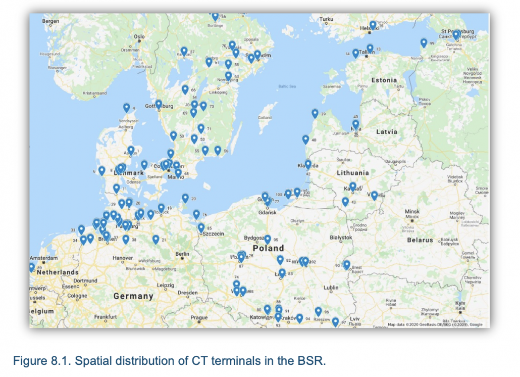
This arrangement is directly reflected in the CT network and location of the terminals. Spatial distribution of CT terminals in the BSR are presented on map (Figure 8.1). Analyzing the geographical distribution of CT terminals, a large number of them are found in the region of the Jutland peninsula. In the northeast of the Baltic Sea (i.e., Lithuania, Latvia, Estonia, and Russia) there are fewer of them. The situation is similar in the north of the Baltic area.
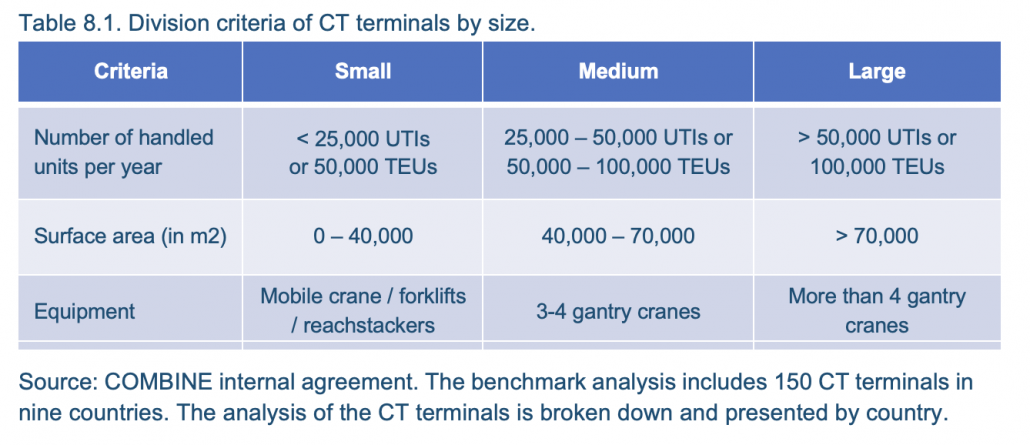
A CT terminal is basically defined as a place with access to at least two transport modes (i.e., rail and road, or sea and rail, etc.), where transshipment of a unitized cargo take place and where other services related to the cargo units and/or transport means can be offered (Table 8.1).